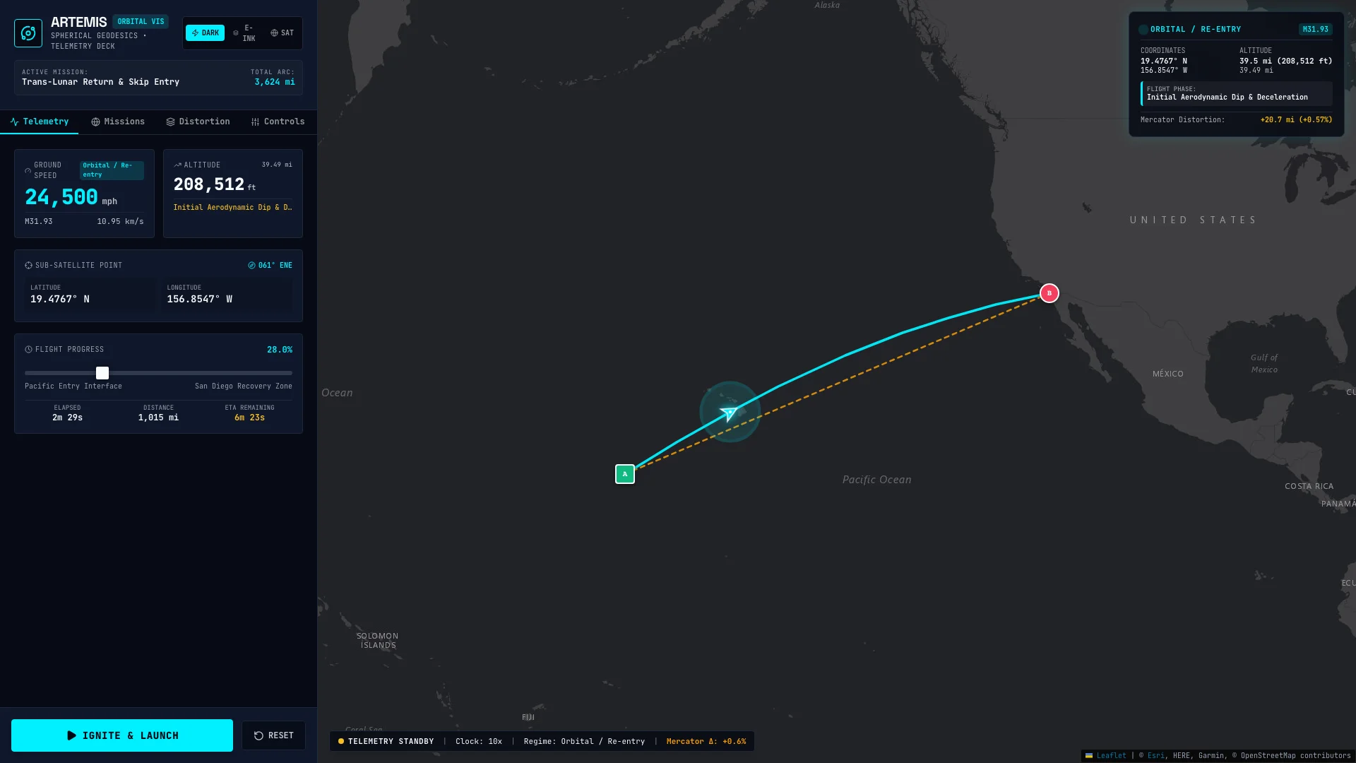
Artemis Velocity Vis
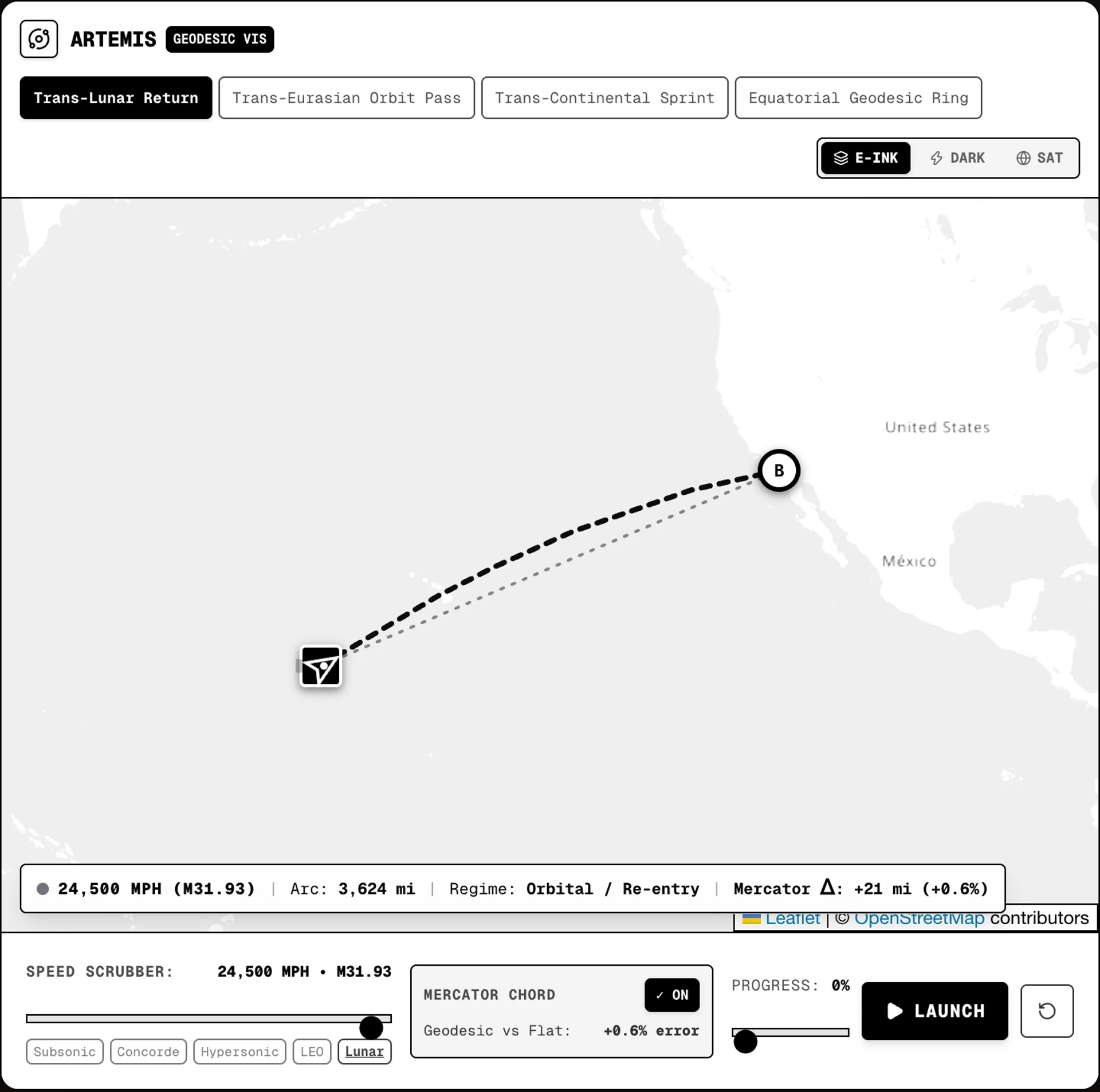
An interactive mission control orbital mechanics laboratory — velocity scrubbing from 500 mph to Mach 32 re-entry, real-time geodesic vs. Mercator distortion analysis, and high-contrast E-Ink cartography.
8 entries · 4 flight presets · 5 velocity regimes
What started as a broken AI Studio zip file export with unmounted tracking components and unused dependencies evolved into a high-precision orbital mechanics laboratory. The initial recon pass was simply about getting a spacecraft speed visualizer back online, but as I pulled out the unused code, the potential for a proper telemetry deck became obvious.
This project serves as Paradigm 2 in the broader Cartography project, exploring the Leaflet rendering pipeline. By pushing Web Mercator to its limits, I wanted to build an interactive dashboard that didn't just plot a line on a map, but modeled the raw physics of orbital re-entry and exposed the inherent geographical distortions of flat maps.
What It Does
Artemis Velocity Vis is an interactive Leaflet map that acts as a real-time flight telemetry dashboard. It features:
- 4 Flight Presets: Trans-Lunar Return, Trans-Eurasian Orbit Pass, Trans-Continental Sprint, and Equatorial Geodesic Ring.
- Continuous Velocity Scrubber: Scale seamlessly from 500 mph (subsonic) all the way to 25,000 mph (orbital re-entry).
- Live Mach Telemetry: Real-time computation of Mach number based on current velocity ().
- Distortion Analysis: An interactive toggle comparing the true spherical geodesic arc against a naïve flat Mercator chord to visualize path error.
- Multi-Theme Telemetry Deck: Switch instantly between E-Ink Electronic Paper, NASA Mission Control Dark, and ESRI Satellite Reconnaissance themes.
Loading Web Mercator tiles and Haversine spherical geodesic projection...
ARTEMIS
ORBITAL VISSpherical Geodesics • Telemetry Deck
Technical Details
Under the hood, the simulator replaces linear interpolation with true spherical mathematics and GPU optimization:
- Spherical Slerp Interpolation: Used to calculate precise great-circle arcs across the globe.
- Haversine Formula: The core math powering the spherical geodesic distances:
- GPU-accelerated CSS Tile Filters: Powers the instant theme switching without re-rendering or refetching map tiles.
- Camera Tracking: Real-time heading vector alignment that keeps the telemetry camera synchronized with the flight path.
- Catmull-Rom Spline: Models the dynamic altitude profiling required for a trans-lunar skip entry.
What I Learned
Working with Leaflet means accepting Web Mercator's distortions, but it also gives you a canvas to challenge them. The geodesic vs. chord comparison makes that distortion visibly and mathematically tangible. When you see a path error on a Tokyo to NYC route—a difference of over a thousand miles—the lie of the flat map becomes the kind of thing you just can't unsee.